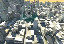
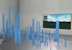
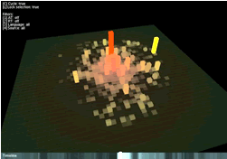
The deadline is near for 2012 entry on the new MRes in Advanced Spatial Analysis and Visualisation (ASAV). The course reflects the current state of play in geographic, urban and architectural information systems with an emphasis on visualisation, analysis and modelling. Taught at the Centre for Advanced Spatial Analysis, home of digital urban, it is an innovative and exciting opputunity to study at UCL with a MRes acting as a pathway to a PhD or further career in ASAV.
Close Menu
Post Tags
3D Max
3dmax
3d modelling
3D Printing
3dsmax
500 words
1940's
A -Games Engines
ABM
academic writing
Agent Based Modelling
Andrew Hudson-Smith
Android
App
AR
AR Media
Art
augmented reality
Autodesk 3D Max
Awesome
Barograph
Big Data
BIM
building outlines
CASA
cityengine
Data
eink
ESRI
Future Cities
iot
lumion
metaverse
NavMesh
News
Pedestrian Modelling
radio
Shortest Path
SketchUp
Smart Cities
UCL
UCL Map
UCL Quad
Unity
weather data
Recent Posts
- Tellus Mater: An AI That Thinks it’s Mother Earth December 5, 2023
- How to Make a Lightsaber Realtime Wind Speed Gauge November 9, 2023
- Reimaging the Traditional Weather House with Open Data, Laser Cutting and 3D Printing August 18, 2023
- Writing 500 Words a Day – The Pomodoro Technique August 10, 2023
- MQTT Scroller for the Pimoroni Stellar Unicorn: THE: Time, Headlines and Environmental Information August 3, 2023
About Salient
The Castle
Unit 345
2500 Castle Dr
Manhattan, NY
Archives
- December 2023
- November 2023
- August 2023
- April 2023
- June 2022
- May 2022
- April 2022
- March 2022
- February 2021
- April 2020
- January 2019
- September 2018
- January 2016
- September 2014
- August 2014
- March 2014
- February 2014
- December 2013
- November 2013
- October 2013
- September 2013
- July 2013
- June 2013
- May 2013
- April 2013
- March 2013
- October 2012
- September 2012
- August 2012
- July 2012
- June 2012
- May 2012
- April 2012
- March 2012
- February 2012
- January 2012
- December 2011
- November 2011
- October 2011
- September 2011
- August 2011
- July 2011
- June 2011
- May 2011
- April 2011
- March 2011
- February 2011
- January 2011
- December 2010
- November 2010
- October 2010
- September 2010
- August 2010
- July 2010
- June 2010
- May 2010
- April 2010
- March 2010
- February 2010
- January 2010
- December 2009
- November 2009
- October 2009
- September 2009
- August 2009
- July 2009
- June 2009
- May 2009
- April 2009
- March 2009
- February 2009
- January 2009
- December 2008
- November 2008
- October 2008
- September 2008
- August 2008
- July 2008
- June 2008
- May 2008
- April 2008
- March 2008
- February 2008
- January 2008
- December 2007
- November 2007
- October 2007
- September 2007
- August 2007
- July 2007
- June 2007
- May 2007
- April 2007
- March 2007
- February 2007
- January 2007
- December 2006
- November 2006
- October 2006
- September 2006
- August 2006
- July 2006
- June 2006
- May 2006
- April 2006
- March 2006
- February 2006
- January 2006
- December 2005
- November 2005
- October 2005
- September 2005
- August 2005
- June 2005
- May 2005
- April 2005
- January 2005

Fantastic views ! I’m also an 3D designer but not prefessional