We are pleased to announce the latest FutureInternet Journal paper as part of the special issue on NeoGeography and WikiPlanning:
WikiGIS Basic Concepts: Web 2.0 for Geospatial Collaboration
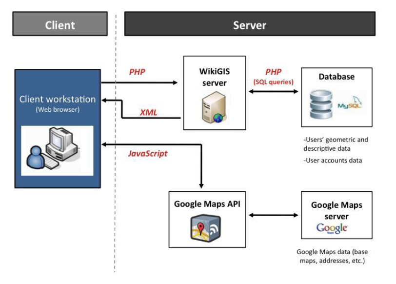
With the emergence of Web 2.0, new applications arise and evolve into more interactive forms of collective intelligence. These applications offer to both professionals and citizens an open and expanded access to geographic information. In this paper, we develop the conceptual foundations of a new technology solution called WikiGIS. WikiGIS’s strength lies
in its ability to ensure the traceability of changes in spatial-temporal geographic components (geometric location and shape, graphics: iconography and descriptive) generated by users. The final use case highlights to what extent WikiGIS could be a relevant and useful technological innovation in Geocollaboration.
As an open access journal you can download the full paper direct from Future Internet.