
Modelling Cities – Update

By Posts

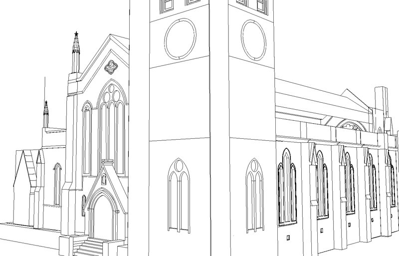
Our model of London extends out to the M25, covering approximately 2000km. Created from LiDAR and Ordnance Survey Mastermap outlines it provides a basic concept of the cities urban morphology. To gain a sense of location and place however you need the local streetscape, from the correct location of the lamppost’s and signage to the development of detailed building facades.

Movie Stage 1 Output


Movie Stage 2 Output


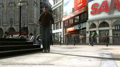
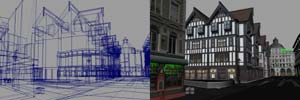
The two movies above illustrate work to date with the project mid-way to completion on modelling the streetscape of Newham in London. The second movie includes air photography on both the ground and the buildings, enhancing the level of realism. The next step is the trees, lamppost’s, signage and the remaining buildings and then finally porting the model into the Oblivion Engine.

Further updates will follow, we should then have a blueprint on how to rapidly model the local streetscape with the aim of rapid architectural visualisation.

Sense of Place in Digital Models

By 3D Modelling, Virtual London


At the moment our team at CASA are working on a digital model of Stratford, the main location of the London Olympics 2012. Developed from a 1 metre digital terrain model and 1 metre LiDAR the model is gradually gaining a sense of location and place. This is all important as once a certain level is reached a digital model begins to gain a level of realism.

Central to this has been the addition of air photography, as soon as a photograph is draped on the roads and the roof tops the model moves to the next level. At the moment we are using 25cm imagery with 12cm following shortly thanks to the Ordnance Survey.

The value of good quality aeriel imagery should not be under estimated in the construction of virtual cities, if you can combine air imagery with street level detail and facades you are half way to a decent model.

A movie of progress to date will follow soon, note all images are work in progress.

Alexandra Palace High Dynamic Range Panorama

By Panoramas 90-100


First opened as “The People’s Palace” in 1873, Alexandra Palace provided the Victorians with a great environment and recreation centre. Just sixteen days after it’s opening, the Palace, which had already attracted over 120,000 visitors, was destroyed by a fire in the dome.

On 1st May 1875, less than 2 years after the destruction of the original building, a new Palace opened. Covering 7 acres, it was centred on the Great Hall, home to the mighty Willis Organ which was driven by two steam engines and vast bellows.

After certain financial difficulties, an Act of Parliament in 1900 created the Alexandra Palace and Park Trust. The Act required the Trustees to maintain the Palace and Park and make them “available for the free use and recreation of the public forever”.

In 1935, the BBC leased the eastern part of the building from which the first public television transmissions were made in 1936. Alexandra Palace was the main transmitting centre for the BBC until 1956, when it was used exclusively for news broadcasts.

You can view the panorama in QuickTime VR (4.1Mb).

The Getaway PS2/PS3 – London – Cities in Games

By Cities in Games

We are updating this post with a new movie illustrating the original Getaway model of London. The movie, embedded further down the post, provides a walk through of various London locations. Of note is the basic modelling to cut down polygon counts and the low resolution textures due to hardware limitations. Despite this the model still stands head and shoulders above almost any architects model of the city today.

*****

London has been featured in many games over the years and in increasing levels of detail as game consoles and budgets increase. In the first of a more detailed look into the production of 3D cities for games we turn our eye to the forthcoming PlayStation 3 and The Getaway.

The Getaway originally appeared on the PlayStation 2 recreating a 3D rendition of London covering approximately 10 square miles (16 square kilometers ). The team produced a wire frame model based on a photographic survey of London and then projected the resulting textures onto the geometry. The game is viewed from the street level allowing some simplification of buildings. In a write up for the BBC Senior producer Peter Edward mentions that “The street sites are like a western movie. They don’t have wooden slates at the back but they are just the fronts”. This is the easiest (if easy is the word) way to rapidly create geometry by ignoring the overall building footprint and pasting on rectified images to create facades.


The recreation of London is impressive and gives an insight into the budget required to build realistic representations of cities in console games. The next Getaway update is scheduled for release to co-inside with the launch of Sony’s PlayStation 3 in November 2006. The movie below shows the model development to date, concentrating on the area around Piccadilly Circus:


The use of High Dynamic Lighting, real time traffic, pedestrian simulations, and detailed geometry is impressive. The game looks like it will represent the state of the art in city modelling.

Close Menu

About Salient

The Castle
Unit 345
2500 Castle Dr
Manhattan, NY

T: +216 (0)40 3629 4753
E: hello@themenectar.com

Archives