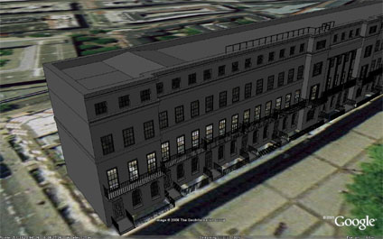
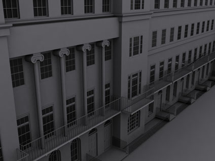
Continuing the development of in house software for rapid city capture we are working on the right hand side of Fitzroy Square. Above is a screen shot of the development so far in Google Earth.
The Google Earth .kmz will be available shortly…
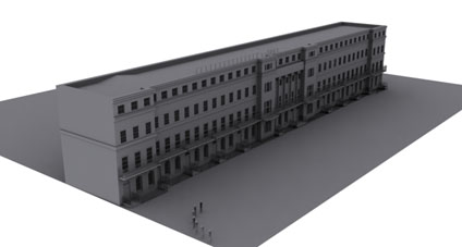
Continuing the development of in house software for rapid city capture we are working on the right hand side of Fitzroy Square. Above is a screen shot of the development so far in Google Earth.
The Google Earth .kmz will be available shortly…
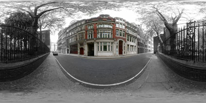
When viewing panoramas it is easy to lose focus on the subject matter and look all around the scene – after all that’s why panoramas are created and placed online. If the subject matter needs to be displayed in context but focused upon then one possibility is to use colour graduation to draw in the eye of the user.
As an example we have created a black and white panorama and added a colour layer to focus the eye on the building – in this case the White Horse Building in Little Britain, London. I’m not sure if it works, but an interesting concept… (?)
View the Quicktime panorama of Little Britain, London (3.2mb).
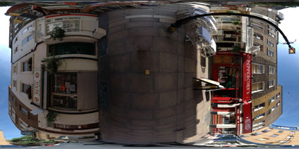
Goodge Place in London’s Fitzrovia is a typical hidden side street which could so easily be walked past. It contains a number of small boutiques, a health food shop and most importantly ‘Dino’ which is one of the areas smallest but best coffee shops.
View the Quicktime panorama of Goodge Place, London (1.4mb).
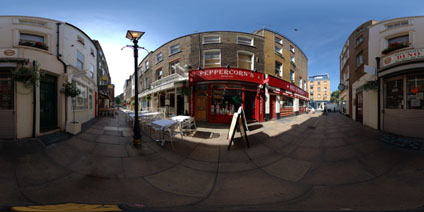
The panorama is taken outside of St Patricks Church in Soho Square, London. St Particks was one of the first Catholic churches established after the passing of the Catholic Relief Acts of 1778 and 1791.
The area around the church was grazing farmland until 1536 when Henry 8th claimed the area as a royal hunting park. The first development took place around the 1600’s with Soho Square dating from 1681.
View the Quicktime panorama of St Patricks Soho Square (3.3mb).