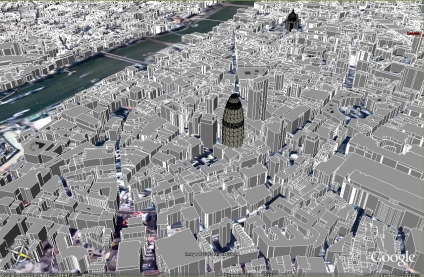
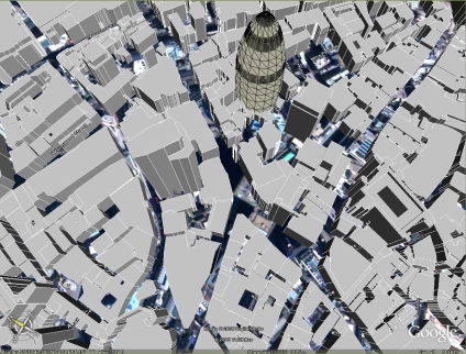
The main area of the Virtual London model was developed in both ESRI’s ArcGlobe and Kinetix 3D Studio Max – largely by Steve Evans at CASA. We have now been able to export this data direct to Google Earth, allowing a rapid model of London to be visualised via the web with acceptable framerates.
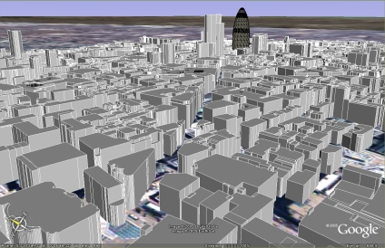
There are issues with placement, most likely due to projection which needs to be addressed, but as a proof of concept it illustrates the ability to port highly detailed data to Google Earth.
Wow – is this going to be publicly available?
Thats the long term aim, there are some copyright issues to sort out with the data, but we are working on it…
Andy
Excellent stuff, been waiting for something exactly like this since I downloaded google earth several months ago.
beautiful work !!!!!!!
What did you guys used to import the files into google earth?
We will feel that all our efforts put into this writing about data have not gone to vain if you get some benefit from reading it. Do wish you were benefited.