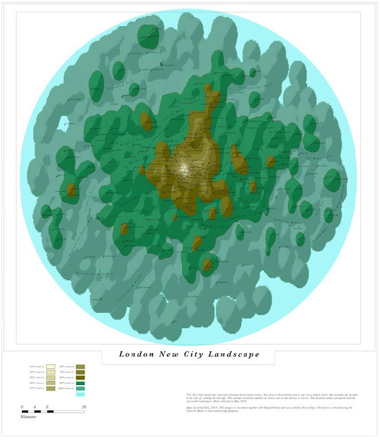
By revealing the social networks present within the urban environment, Invisible Cities describes a new kind of city—a city of the mind. The movie below by Christian Marc Schmidt displays geocoded activity from online services such as Twitter and Flickr, both in real-time and in aggregate. Real-time activity is represented as individual nodes that appear whenever a message or image is posted. Aggregate activity is reflected in the underlying terrain: over time, the landscape warps as data is accrued, creating hills and valleys representing areas with high and low densities of data.
In the piece, nodes are connected by narrative threads, based on themes emerging from the overlaid information. These pathways create dense meta-networks of meaning, blanketing the terrain and connecting disparate areas of the city:
Invisible Cities maps information from one realm—online social networks—to another: an immersive, three dimensional space. In doing so, the piece creates a parallel experience to the physical urban environment. The interplay between the aggregate and the real-time recreates the kind of dynamics present within the physical world, where the city is both a vessel for and a product of human activity. It is ultimately a parallel city of intersections, discovery, and memory, and a medium for experiencing the physical environment anew.
Our movie below of London’s Tweets displays a similar ‘hidden city’:

This is interesting, though I find a little disturbing the people tweeting from the middle of the runway at Heathrow airport in the London twitter cliud film- that’s either groundstaff not concentrating, pilots not flying, or passengers not turning off their phones…!
This is interesting, though I find a little disturbing the people tweeting from the middle of the runway at Heathrow airport in the London twitter cliud film- that’s either groundstaff not concentrating, pilots not flying, or passengers not turning off their phones…!
How were you able to do this?
“As we posted a few weeks ago, we have been harvesting geospatial data from Twitter with the aim of creating a series of new city maps based on Twitter data.”