
London Google Earth 1690 – Tweak

By Posts

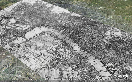
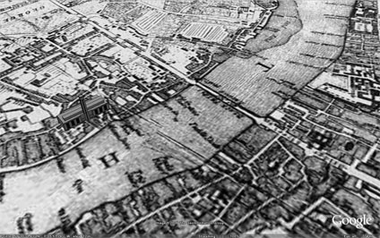
The image overlay of London 1690 has received a lot of interest. So much so that we now have a project at the lab to put more of these up as soon as copyright is cleared.

Frank Taylor from the excellent Google Earth Blog has sent us a tweak to the original file so that the Tate Modern now sits on the banks of the Thames rather than slightly in it due to a misalign. Thanks for that Frank.

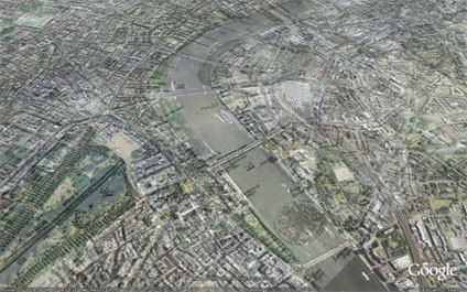
A number of key landmarks which were around in London 1690 and other overlays which are coming shortly will be added. Hopefully making it a good resource of the teaching of History and Geography.

You can download the kmz file to fly into the overlay in Google Earth here

Sneak Peak Google Earth London

By Google Earth 10-20, Virtual London

We have posted a number of models recently so we thought we would post an image of the level of detail we are working on in Google Earth London. This is a first phase test for new modeling techniques developed at CASA.

Sample high detail Google Earth files will follow shortly….

London Google Earth 1690

By Google Earth 10-20

Using image overlays it is possible to compare cities over time. The above and below images illustrate the layout of London in 1690 – post Fire of London – in Google Earth. It is interesting to note when changing the transparency how the shape of the Thames has been modified with the building of Embankment.

You can download the kmz file to fly into the overlay in Google Earth here

Close Menu

About Salient

The Castle
Unit 345
2500 Castle Dr
Manhattan, NY

T: +216 (0)40 3629 4753
E: hello@themenectar.com

Archives