*Edit - Kmz link now fixed - *
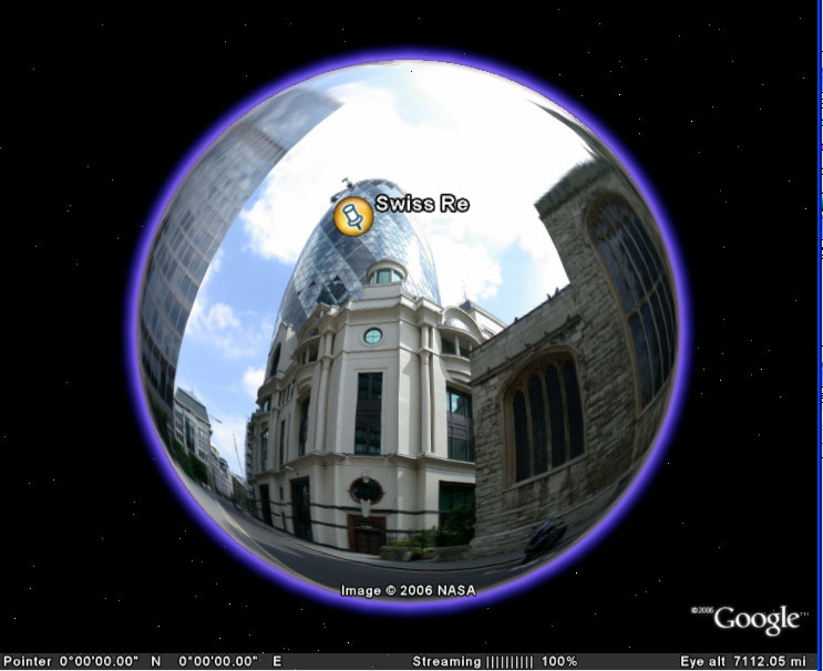
While capturing screengrabs for our tutorial on creating panoramas from Google Earth we got thinking that you could use the Earth itself as a panoramic image viewer.
All of our panoramas on the blog cover a 360x180 degree field of view - ie a sphere. By adding a new Google Earth overlay you can load a panoramic image and wrap it around the globe, thus allowing you to use the Earth as a viewer.
As its Google Earth you can then add placemarks to navigate to buildings of interest, in our case the Swiss Re and Lloyds buildings in the City of London.
Of course this is not all that practical, but it works... To try it out yourself download our kmz file and take a look at the panorama of the City of London, or edit the image path and load up your own panoramic view...
Thoughts or comments are as ever welcome.
Using Google Earth as a Panorama Viewer
Andy
CASA, UCL East
Recent
The Papers: The 2nd Album
Spatial Computing and the Phygital City: Towards Digital Habitation
Color Weather: A Data Watch Face for the Pebble Time 2
Fenland: A weeWX Dashboard with forecast verification, ensemble models, climate records back to 1940 and finally, that tween...
City Clock: A City where the People Tell the Time