What if London’s buildings grew according to the amount of data they generate? Stephan Hügel (@urschrei) and Flora Roumpani (@en_topia) two of our PhD students from The Bartlett Centre for Advanced Spatial Analysis, University College London, have been working on a system to read in twitter data to CityEngine and link the geo locations to building outlines.
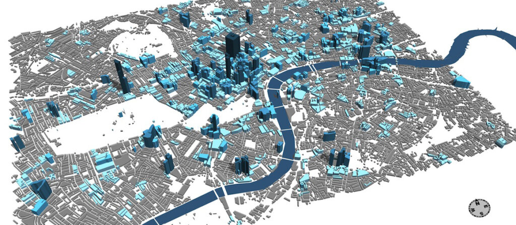
Twitter Data linked to Building Footprints
For more info head over to http://en-topia.blogspot.co.uk/2013/07/tweetcity-re-populating-london.html and to download source code: http://urschrei.github.io/CityEngine-…