Mapping Games – Ultima VII

By Mapping Games 6 Comments

The rise of simple to use geographic information systems such as Google Maps and Microsoft’s Virtual Earth are making it increasingly easy to map any information which is geographically organised. As such maps do not have to link to the real world, virtual and game space can also be mapped and displayed using the same set of tools.

To date we have looked at Mapping Second Life and Lord of the Rings Online, the latest in our series of posts on Mapping Games looks at Ultima VII. Ultima VII, released in two parts, Ultima VII: The Black Gate (1992), and Ultima VII Part Two: Serpent Isle (1993) is an interesting choice to map and display online due in part to its age and therefore level of graphic resolution.

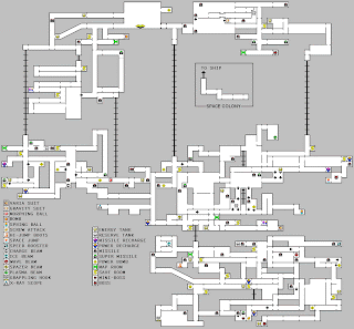
Previous to the ability to create tiles in geographical space and display them via Google or Microsoft technologies maps of games often took on a ‘overview’ structure to simply communicate location.

The image below illustrates such an example:

Using Exult to extract image tiles, Nikolai Faaland has taken mapping Ultima VII a stage further and ported it into Virtual Earth:


The map can viewed in both 2D mode as pictured above and 3D:


Mapping games such as Ultima VII is an interesting use of Virtual Earth and one that we will be covering further in future posts.

Click here to see the map in Virtual Earth

Holographic Display’s – Digital Cities and Digital Earth

By Future, Google Earth, Holographic No Comments

Recently there has been a number of developments in holographic technologies that are bringing the prospect of office and home based small-form 3D projection closer to reality. In this post we take a look the current leaders in the field and look into the prospect for digital cities and a virtual earth floating in 3D real-space.

Heliodisplay

First up is the Heliodisplay which is ready to go technology at a cost of $20,000. Heliodisplay is based around patented and patent pending technology to transform normal ambient air and display video images into free-space. The YouTube video embedded below provides a good overview:


Fogscreen

Similar to the Heliodisplay is the Fogscreen which uses water droplets as the medium for projection. Fogscreen is literally just a screen and any projector can be used, with this in mind it is mainly aimed at ‘walkthrough‘ advertising – Beyond Tomorrow take a look at the technology below:

CheoOptics 3D

Both Heliodisplay and Fogscreen are flat surface technologies, to move towards a full holographic display you need to be able to view the image from any angle. CheoOptics’s technology uses a pyramidal structure to enable a 360 degree image to be projected up to 30 meters in size. While not suited to the home environment the movie below provides an intriguing insight into where the technology is moving:


LED Display

To step back to smaller scale a floating Virtual Globe is desirable, especially if sometime in the future there is a way to project Google Earth type information into the real-space. A basic example can be made using spinning LED’s a per the movie below:

A similar, yet physical result can be achieved by simply using display technology made into a sphere. The earth below is simple yet effective:


Looking down the line at small-form display technology, Hitachi has announced news of a new device utilising an array of mirrors to imagery in a manner that creates the illusion of a three dimensional image – as pictured:


Read more about the stereoscopic display via Hitachi (Japanese link)

Holographic and stereoscopic displays are gradually reaching the marketplace, indeed, it looks like within 5 years we may well be able to view a digital earth or 3D model of a city floating in real-space.

With this technology comes the possibility to visualise and communicate data in new and exciting ways, link this with mutli-user worlds ala Second Life and it suddenly becomes a 3D multi-user network displayed in cartesian space.

Londonist’s View of the Ordnance Survey

By Ordnance Survey No Comments

We are merely passing on a link in this post as Londonist has published its own unique views on the Ordnance Survey and Google issue regarding data licensing.

Suffice to say it made us smile but also worry slightly in a ‘we need to distance ourselves from all this for the sake of our career’ sort of way.

We will publish a list of articles related to this issue next week – a number of people in the industry have been passing comment on various sites and blogs which make interesting reading.

As for our view – well we are probably too close to the subject to comment but there are complex issues that need to be raised with regards data licensing.

See the Londonist article on the Ordnance Survey.

MapJack – Sneak Peak at Flash Street View (Beta)

By MapJack, Street View 2 Comments

After our side by side comparasion of MapJack, Everyscape and Google’s Street View a couple of days ago the people behind MapJack have been in touch with regards a new beta version running in flash.

Screen grabbed above the new version, planned to preview next week, is an interesting take on the street view concept. Firstly, it allows the user to navigate via the keyboard, creating a semi-immersive way to visualise the city. This interface change is definitely preferable to clicking on hotspots to move onto the next view.

Simple image transitions are also now in place and via a toolbar the way the images are viewed can be changed – note the projection option:

The beta version is well worth a look, the guys behind MapJack have kindly agreed to allow us to publish a sneak look:

http://www.mapjack.com/FlashTest/Index.html

Let us know any thoughts…

Close Menu

About Salient

The Castle
Unit 345
2500 Castle Dr
Manhattan, NY

T: +216 (0)40 3629 4753
E: hello@themenectar.com