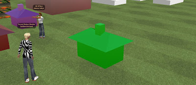
It may not look like much – the Monopoly style house pictured above in Second Life – but this captures the moment our Second Life Importer for .obj files started working. Made in 3D Studio Max the house was saved as a .obj, run through our in house software and saved as a Sculpt Map for import into our section of Second Life.
We plan to make the software either freely or for a very small fee available once its complete. At the moment all the models appear in the preview window as intended yet once imported into Second Life they have a tendency to implode.
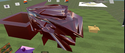
Pictured below is the same house imploded:
Joel in our lab is working through the issues, if you have any thoughts feel free to get in touch.
If this works we may well have a simple route for importing 3d objects into Second Life.
You can view more details on our work in Second Life and come by for a visit via details in our previous posts.


